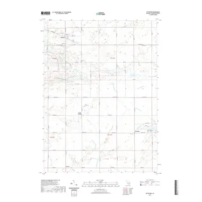
2019 Map of Pittsford
USGS Topo · Published 2019About this map
Pittsford serves as the primary hub in this rural landscape, characterized by its historic street grid and proximity to the Pittsford Millpond. The surrounding countryside in Hillsdale County is defined by a dense network of water features, including the winding E Br Saint Joseph River and numerous numbered lakes such as Lake Number Five and Lake Number Eight. Small settlements like Lickly Corners and Prattville anchor the southern portion of the area, while the N Country National Scenic Trail cuts through the central terrain, offering a modern perspective on a landscape long shaped by agriculture and water management. Genealogists will find significant value in the documentation of several local burial sites, notably the Leonardson Cem, Prattville Cem, and the unique Bacon Farm Grave. The map also captures several distinct drainage systems, such as the Anderson Drain and Dillon Drain, which illustrate the complex hydrology necessary for maintaining the region's farmland.
Find a feature on this map
76 named features on this map. Tap any name to fly to it.
Don’t see what you’re looking for? This feature index may not catch every label — zoom into the map to look around manually.
Map Details
Editions of this 2019 Pittsford Map
This is the sole edition of this map. No revisions or reprints were ever made.
Other maps of this area

1913 · Alvordton
USGS Topo · 1:62,500

1914 · Pioneer
USGS Topo · 1:62,500

1944 · Pioneer
USGS Topo · 1:62,500

1944 · Alvordton
USGS Topo · 1:62,500

1953 · Fort Wayne
USGS Topo · 1:250,000

1956 · Fort Wayne
USGS Topo · 1:250,000

1959 · North Adams
USGS Topo · 1:24,000

1959 · Frontier
USGS Topo · 1:24,000

1960 · Fayette
USGS Topo · 1:24,000
1961 · Pioneer
USGS Topo · 1:24,000