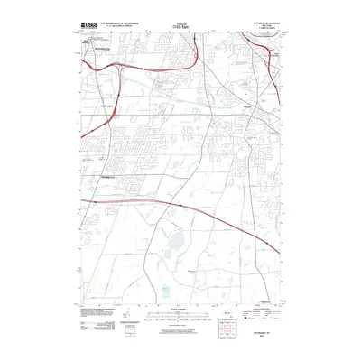
2010 Map of Pittsford
USGS Topo · Published 2010About this map
Pittsford and the southern suburban reaches of Rochester are defined by a sophisticated network of surface roads and the historic path of the Canal. This survey captures the suburban evolution of Monroe County, from the institutional grounds of the University of Rochester School of Medicine and Dentistry in the north to the more open landscapes around Woodchuck Hollow and Quaker Pond in the south. The area maintains a connection to its early history through landmarks like the Pioneer Burying Ground and the Cartersville Guard Gate along the waterway.
Find a feature on this map
62 named features on this map. Tap any name to fly to it.
Don’t see what you’re looking for? This feature index may not catch every label — zoom into the map to look around manually.
Map Details
Editions of this 2010 Pittsford Map
This is the sole edition of this map. No revisions or reprints were ever made.
Other maps of this area

1895 · Rochester
USGS Topo · 1:62,500

1898 · Rochester
USGS Topo · 1:62,500

1900 · Macedon
USGS Topo · 1:62,500

1900 · Canandaigua
USGS Topo · 1:62,500

1901 · Honeoye
USGS Topo · 1:62,500

1903 · Canandaigua
USGS Topo · 1:62,500

1904 · Honeoye
USGS Topo · 1:62,500

1912 · Rochester
USGS Topo · 1:62,500

1920 · Rochester
USGS Topo · 1:62,500

1931 · Mendon Ponds
USGS Topo · 1:24,000