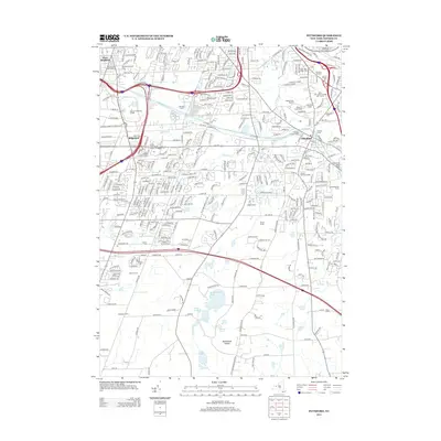
2013 Map of Pittsford
USGS Topo · Published 2013About this map
The Erie Canal winds through this modern suburban landscape, anchoring the village of Pittsford and reflecting its historic role as a transit hub south of Rochester. Educational institutions figure prominently across the terrain, from Monroe Community College in the west to Saint John Fisher Coll and Nazareth College near the eastern border. These campuses sit alongside established residential developments like Ridgeland and Pittsford Village Green, while the presence of the County Fairgrounds and several large farm tracts, such as Willard Farms and Silco Farms, indicates a lingering connection to the area's agricultural past.
Find a feature on this map
53 named features on this map. Tap any name to fly to it.
Don’t see what you’re looking for? This feature index may not catch every label — zoom into the map to look around manually.
Map Details
Editions of this 2013 Pittsford Map
This is the sole edition of this map. No revisions or reprints were ever made.
Other maps of this area

1895 · Rochester
USGS Topo · 1:62,500

1898 · Rochester
USGS Topo · 1:62,500

1900 · Macedon
USGS Topo · 1:62,500

1900 · Canandaigua
USGS Topo · 1:62,500

1901 · Honeoye
USGS Topo · 1:62,500

1903 · Canandaigua
USGS Topo · 1:62,500

1904 · Honeoye
USGS Topo · 1:62,500

1912 · Rochester
USGS Topo · 1:62,500

1920 · Rochester
USGS Topo · 1:62,500

1931 · Mendon Ponds
USGS Topo · 1:24,000