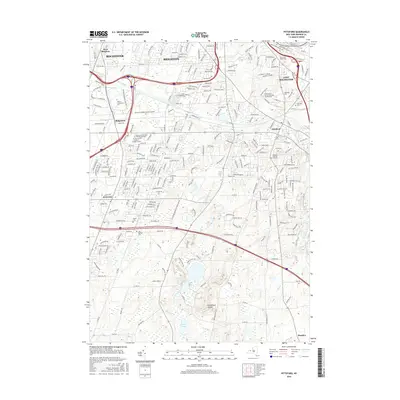
2016 Map of Pittsford
USGS Topo · Published 2016About this map
The Erie Canal winds through the heart of this landscape, tracing the historical industrial corridor that shaped Pittsford and East Rochester. This contemporary topographical perspective highlights the densification of suburban Rochester and Brighton, where academic institutions like Saint John Fisher Coll and Nazareth Coll occupy significant tracts of land. Beyond the modern road networks, the map preserves the locations of early local history, including the Pioneer Burying Ground and the East Baptist Cem. To the south, the terrain becomes more varied as it transitions toward Mendon, featuring unique natural landmarks such as Devils Bathtub, Quaker Pond, and the depression of Woodchuck Hollow. The survey clearly delineates the Brighton Henrietta Town Line Rd, reflecting the formal administrative boundaries that have persisted through centuries of development in Monroe County.
Find a feature on this map
253 named features on this map. Tap any name to fly to it.
Don’t see what you’re looking for? This feature index may not catch every label — zoom into the map to look around manually.
Map Details
Editions of this 2016 Pittsford Map
This is the sole edition of this map. No revisions or reprints were ever made.
Other maps of this area

1895 · Rochester
USGS Topo · 1:62,500

1898 · Rochester
USGS Topo · 1:62,500

1900 · Macedon
USGS Topo · 1:62,500

1900 · Canandaigua
USGS Topo · 1:62,500

1901 · Honeoye
USGS Topo · 1:62,500

1903 · Canandaigua
USGS Topo · 1:62,500

1904 · Honeoye
USGS Topo · 1:62,500

1912 · Rochester
USGS Topo · 1:62,500

1920 · Rochester
USGS Topo · 1:62,500

1931 · Mendon Ponds
USGS Topo · 1:24,000