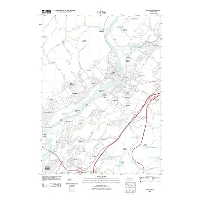
2010 Map of Pittston
USGS Topo · Published 2010About this map
The Susquehanna River carves a wide path through this industrial and residential corridor, where the confluence with the Lackawanna River historically anchored the region's transportation network. The rail infrastructure is prominent, featuring the extensive Pittston Yards and Pittston Junction, which supported the heavy industry of towns like West Pittston, Exeter, and Swoyersville. These settlements are tightly packed along the riverbanks, interspersed with significant landmarks like the Wilkes-Barre Wyoming Valley Airport and several historic burial grounds, including the Forty Fort Cemetery and Memorial Shrine Cemetery. To the east, the terrain rises toward Peterson Mountain, while the river itself is dotted with several large landmasses such as Scovell Island and Wintermoot Island, reflecting the complex hydrology that shaped the development of the Wyoming Valley.
Find a feature on this map
113 named features on this map. Tap any name to fly to it.
Don’t see what you’re looking for? This feature index may not catch every label — zoom into the map to look around manually.
Map Details
Editions of this 2010 Pittston Map
This is the sole edition of this map. No revisions or reprints were ever made.
Other maps of this area

1889 · Scranton
USGS Topo · 1:62,500

1891 · Wilkesbarre
USGS Topo · 1:62,500

1891 · Scranton
USGS Topo · 1:62,500

1893 · Pittston
USGS Topo · 1:62,500

1893 · Scranton
USGS Topo · 1:62,500

1894 · Wilkesbarre
USGS Topo · 1:62,500

1922 · Stoddartsville
USGS Topo · 1:62,500

1924 · Stoddartsville
USGS Topo · 1:62,500

1943 · Scranton
USGS Topo · 1:125,000

1943 · Stoddartsville
USGS Topo · 1:62,500