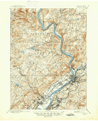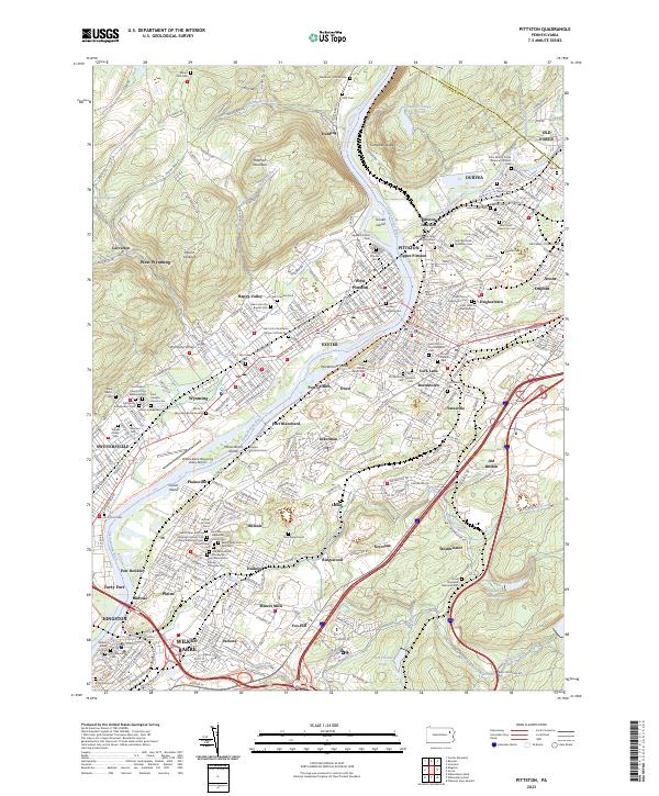
1976 Map of Pittston
USGS Topo · Published 1979About this map
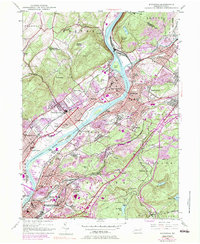
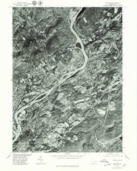
The Susquehanna River winds through the heart of the Wyoming Valley in this 1976 orthophotoquad, revealing a dense corridor of industrial and residential development. In contrast to traditional topographic maps, this aerial view provides a direct visual record of the land use patterns surrounding Wilkes-Barre and Pittston during the late 1970s. The image captures the complex network of transportation and urban density that characterizes this coal-region landscape. Smaller boroughs like Avoca and Dupont are visible on the eastern bank, while Swoyersville and Kingston occupy the western floodplains. The orthophotography allows for the identification of specific building footprints, large-scale industrial sites, and the scars of extensive mining operations that shaped the valley’s history. It is a precise documentation of the region before significant modern commercial redevelopment altered the mid-century urban fabric.
Find a feature on this map
7 named features on this map. Tap any name to fly to it.
Don’t see what you’re looking for? This feature index may not catch every label — zoom into the map to look around manually.
Map Details
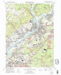
Editions of this 1976 Pittston Map
This is the sole edition of this map. No revisions or reprints were ever made.
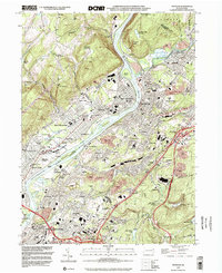
Historical Maps of Wilkes-Barre Through Time
7 maps found