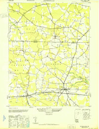
1946 Map of Pittsville
USGS Topo · Published 1946About this map
The borderlands between Wicomico County, Maryland, and Sussex County, Delaware, are defined by a network of drainage ditches and branches in this 1946 survey. The town of Pittsville serves as a primary hub, situated near the Pittsville West Base landmark and the marshy expanses of Jack White Swamp and Hamlin Swamp. To the west, the settlement of Parsonsburg anchors the landscape, while smaller hamlets like Melson, Whitesville, and Pepperbox are scattered along the local road network.
Find a feature on this map
38 named features on this map. Tap any name to fly to it.
Don’t see what you’re looking for? This feature index may not catch every label — zoom into the map to look around manually.
Map Details
Editions of this 1946 Pittsville Map
This is the sole edition of this map. No revisions or reprints were ever made.
Other maps of this area

1901 · Salisbury
USGS Topo · 1:62,500

1902 · Pittsville
USGS Topo · 1:62,500

1915 · Seaford
USGS Topo · 1:62,500

1917 · Millsboro
USGS Topo · 1:62,500

1938 · Millsboro
USGS Topo · 1:62,500

1942 · Ninepin
USGS Topo · 1:24,000

1942 · Wango
USGS Topo · 1:24,000

1942 · Whaleysville
USGS Topo · 1:24,000

1942 · Salisbury
USGS Topo · 1:24,000

1942 · Delmar
USGS Topo · 1:24,000