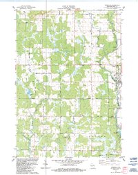
1984 Map of Pittsville
USGS Topo · Published 1984About this map
The Yellow River winds through this Wood County landscape, anchoring the settlement of Pittsville and the recreational waters of Lake Dexter. By the mid-1980s, the area reflects a mix of small-town development and rural utility, with the Green Bay and Western railroad corridor passing south of the main town center. Local history is etched into the land via sites like St Joachims Cem, Mound Cem, and the prominent Cary Mound to the northwest.
Find a feature on this map
45 named features on this map. Tap any name to fly to it.
Don’t see what you’re looking for? This feature index may not catch every label — zoom into the map to look around manually.
Map Details
Editions of this 1984 Pittsville Map
This is the sole edition of this map. No revisions or reprints were ever made.
Other maps of this area

1953 · Eau Claire
USGS Topo · 1:250,000

1954 · Granton
USGS Topo · 1:62,500

1954 · Marshfield
USGS Topo · 1:62,500

1957 · Pittsville
USGS Topo · 1:48,000

1957 · City Point
USGS Topo · 1:48,000

1958 · Eau Claire
USGS Topo · 1:250,000

1964 · Eau Claire
USGS Topo · 1:250,000

1967 · Pittsville
USGS Topo · 1:62,500

1970 · City Point NE
USGS Topo · 1:24,000
1970 · City Point
USGS Topo · 1:24,000