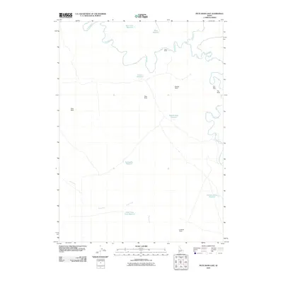
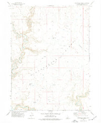
2010 Map of Piute Basin East
USGS Topo · Published 2010About this map
Owyhee River meanders across the northern and eastern portions of this high desert landscape, carving a distinct path through Owyhee County. The terrain is characterized by broad basins and prominent volcanic features, including Piute Butte and Lookout Butte, which dominate the central and southern elevations. The distribution of water in this arid environment is managed through a series of specialized catchments such as Packsaddle Reservoir and Weather Station Reservoir. Evidence of human activity and livestock management is visible at Wiley Ranch and the Piute Basin Camp, connected by a network of unimproved roads. Further south, Piute Creek feeds into the Upper Piute Creek Reservoir, illustrating the critical role of water infrastructure in supporting ranching and remote operations across the Piute Basin.
Find a feature on this map
17 named features on this map. Tap any name to fly to it.
Don’t see what you’re looking for? This feature index may not catch every label — zoom into the map to look around manually.
Map Details
Editions of this 2010 Piute Basin East Map
This is the sole edition of this map. No revisions or reprints were ever made.
Other maps of this area

1955 · Jordan Valley
USGS Topo · 1:250,000

1957 · Jordan Valley
USGS Topo · 1:250,000

1958 · Jordan Valley
USGS Topo · 1:250,000

1971 · Juniper Basin
USGS Topo · 1:24,000
1971 · Jarvis Pasture
USGS Topo · 1:24,000
1972 · Battle Creek Lakes
USGS Topo · 1:24,000
1973 · Piute Basin West
USGS Topo · 1:24,000

1973 · Bull Camp Butte
USGS Topo · 1:24,000

1973 · Brace Flat
USGS Topo · 1:24,000
1973 · Dickshooter Ridge
USGS Topo · 1:24,000