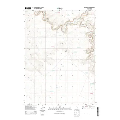
2013 Map of Piute Basin East
USGS Topo · Published 2013About this map
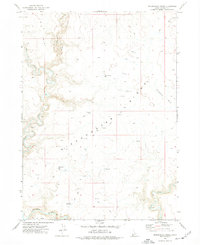
Owyhee Canyon and the Owyhee River anchor this remote high-desert landscape in southwestern Idaho. The terrain is defined by a series of basins and plateaus, notably Kimbal Basin and the vast Y P Desert, which are dotted with dozens of small impoundments such as Wiley Reservoir, Petition Reservoir, and Clay Bottom Reservoir. These water sources are critical markers of human activity in an arid environment, supporting livestock at outposts like Wiley Ranch and the Piute Basin Camp. Distinctive landmarks such as Piute Butte and the marshy area known as The Tules provide navigational orientation across the wide expanses. The drainage network, including Piute Cr and Battle Creek, carves through the volcanic geology of the region, illustrating the long-term patterns of land use and water management in this high-elevation desert.
Find a feature on this map
28 named features on this map. Tap any name to fly to it.
Don’t see what you’re looking for? This feature index may not catch every label — zoom into the map to look around manually.
Map Details
Editions of this 2013 Piute Basin East Map
This is the sole edition of this map. No revisions or reprints were ever made.
Other maps of this area

1955 · Jordan Valley
USGS Topo · 1:250,000

1957 · Jordan Valley
USGS Topo · 1:250,000

1958 · Jordan Valley
USGS Topo · 1:250,000

1971 · Juniper Basin
USGS Topo · 1:24,000
1971 · Jarvis Pasture
USGS Topo · 1:24,000
1972 · Battle Creek Lakes
USGS Topo · 1:24,000
1973 · Piute Basin West
USGS Topo · 1:24,000

1973 · Bull Camp Butte
USGS Topo · 1:24,000

1973 · Brace Flat
USGS Topo · 1:24,000
1973 · Dickshooter Ridge
USGS Topo · 1:24,000