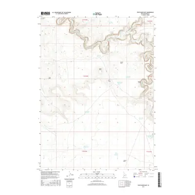
2017 Map of Piute Basin East
USGS Topo · Published 2017About this map
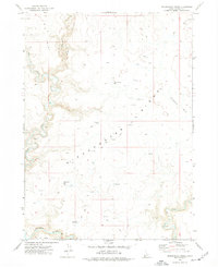
The Owyhee River carves a winding path through the northern reaches of this landscape, its course defined by the deep incisions of Owyhee Canyon. This high desert environment is characterized by a series of basins and volcanic features, notably the Piute Butte and the broad Piute Basin. The region's reliance on water management is evident in the numerous catchment systems scattered across the terrain, including Packsaddle Reservoir, Upper Piute Cr Reservoir, and the North Lookout Reservoir. In the eastern section, the terrain transitions into the Y P Desert and a unique marshy area known as The Tules. Further south, the prominence of Lookout Butte serves as a significant navigational landmark over the surrounding plains, where Piute Creek and its associated reservoirs provide vital water sources in an otherwise arid expanse.
Find a feature on this map
28 named features on this map. Tap any name to fly to it.
Don’t see what you’re looking for? This feature index may not catch every label — zoom into the map to look around manually.
Map Details
Editions of this 2017 Piute Basin East Map
This is the sole edition of this map. No revisions or reprints were ever made.
Other maps of this area

1955 · Jordan Valley
USGS Topo · 1:250,000

1957 · Jordan Valley
USGS Topo · 1:250,000

1958 · Jordan Valley
USGS Topo · 1:250,000

1971 · Juniper Basin
USGS Topo · 1:24,000
1971 · Jarvis Pasture
USGS Topo · 1:24,000
1972 · Battle Creek Lakes
USGS Topo · 1:24,000
1973 · Piute Basin West
USGS Topo · 1:24,000

1973 · Bull Camp Butte
USGS Topo · 1:24,000

1973 · Brace Flat
USGS Topo · 1:24,000
1973 · Dickshooter Ridge
USGS Topo · 1:24,000