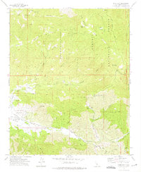
1972 Map of Piute Peak
USGS Topo · Published 1975About this map
King Solomons Mine and the Horshoe Mine sit tucked into the canyons of the Sequoia National Forest, marking a landscape defined by 20th-century resource extraction and thermal features. The topography is dominated by the height of Piute Peak and the high ridgelines of Solomons Ridge, giving way to the expansive Walker Basin in the southwest. This area serves as a transition from the wooded heights of Piute Mountain to the ranching and livestock operations indicated by several springs and a Landing Strip. Local infrastructure is evident through the presence of a Substation and the winding Walker Basin Road, which follows the contours of the valley floor. Rare thermal activity is noted at Yates Hot Springs, while small-scale local history is preserved at a high-elevation Cem and namesake locations like Skinner Flat.
Find a feature on this map
40 named features on this map. Tap any name to fly to it.
Don’t see what you’re looking for? This feature index may not catch every label — zoom into the map to look around manually.
Map Details
Editions of this 1972 Piute Peak Map
3 editions found
Other maps of this area

1906 · Kernville
USGS Topo · 1:125,000

1908 · Kernville
USGS Topo · 1:125,000

1914 · Caliente
USGS Topo · 1:125,000

1915 · Mojave
USGS Topo · 1:125,000

1920 · Delonagha
USGS Topo · 1:62,500

1926 · Glennville
USGS Topo · 1:62,500

1936 · Tobias Peak
USGS Topo · 1:125,000

1943 · Emerald Mtn
USGS Topo · 1:62,500

1943 · Breckenridge Mountain
USGS Topo · 1:62,500

1943 · Tobias Peak
USGS Topo · 1:125,000