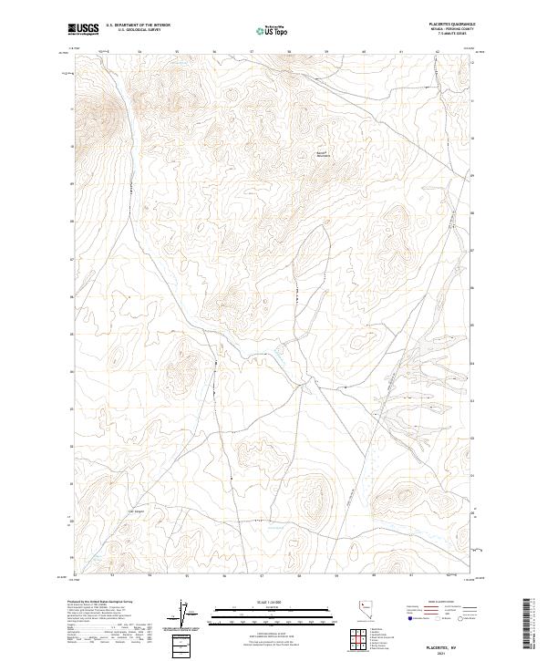
2021 Map of Placerites
USGS Topo · Published 2021About this map
The Kamma Mountains dominate this high-desert landscape in Pershing County, where water is the primary driver of names and movement. Remote springs such as Outlaw Spring, Corral Spring, and Judges Springs provide critical landmarks across the arid terrain. The map traces the path of Seven Troughs Rd as it skirts the eastern mountain edges, following a historic corridor through the Great Basin. Drainage patterns like Rabbithole Cr and the winding Cow Canyon illustrate the natural runoff routes that define the topography between the township lines of T33N and T32N. This survey documents the intersection of essential ranching or survival resources in a sparsely populated section of the Nevada desert.
Find a feature on this map
11 named features on this map. Tap any name to fly to it.
Don’t see what you’re looking for? This feature index may not catch every label — zoom into the map to look around manually.
Map Details
Editions of this 2021 Placerites Map
This is the sole edition of this map. No revisions or reprints were ever made.
Other maps of this area

1931 · Lovelock
USGS Topo · 1:250,000

1935 · Lovelock
USGS Topo · 1:250,000

1955 · Lovelock
USGS Topo · 1:250,000

1959 · Lovelock
USGS Topo · 1:250,000
1981 · Sawtooth Knob
USGS Topo · 1:24,000

1981 · Dead Horse Canyon NE
USGS Topo · 1:24,000

1981 · Scossa
USGS Topo · 1:24,000

1981 · Placerites
USGS Topo · 1:24,000
1981 · Poker Brown Gap
USGS Topo · 1:24,000
1981 · Sulphur
USGS Topo · 1:24,000