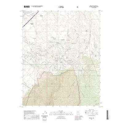
2023 Map of Placitas
USGS Topo · Published 2023About this map
The Sandia Mountains dominate the southern landscape of this New Mexico quadrangle, where the high peaks of the Sandia Mountain Wilderness and Cibola National Forest give way to a complex network of arroyos and canyons. Settlement is concentrated along the northern corridor and the foothills, featuring the historic lands of Santa Ana Pueblo and the communities of Algodones and Placitas. The map reveals a transition from the riparian environment of Las Huertas Creek to the sharp rises of the Crest of Montezuma. Genealogists and local historians can locate several burial sites, including the Algodones Cem and the San Antonio de Las Huertas Land Grant Cem, which reflect the deep roots of the land grant and pueblo systems in Sandoval County.
Find a feature on this map
125 named features on this map. Tap any name to fly to it.
Don’t see what you’re looking for? This feature index may not catch every label — zoom into the map to look around manually.
Map Details
Editions of this 2023 Placitas Map
This is the sole edition of this map. No revisions or reprints were ever made.
Other maps of this area

1888 · Bernalillo
USGS Topo · 1:125,000

1889 · Albuquerque
USGS Topo · 1:125,000

1892 · San Pedro
USGS Topo · 1:125,000

1893 · Albuquerque
USGS Topo · 1:125,000

1934 · Alameda
USGS Topo · 1:24,000

1938 · Albuquerque
USGS Topo · 1:62,500

1954 · Sandia Crest
USGS Topo · 1:24,000

1954 · Alameda
USGS Topo · 1:24,000

1954 · San Felipe Pueblo
USGS Topo · 1:24,000

1954 · Placitas
USGS Topo · 1:24,000