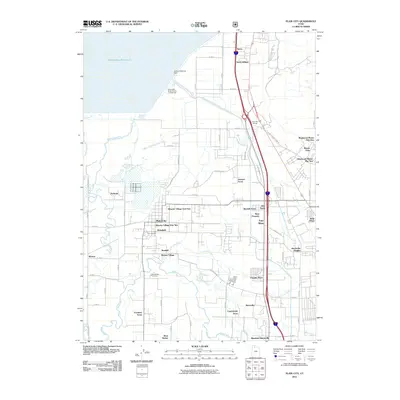
2011 Map of Plain City
USGS Topo · Published 2011About this map
The Arthur V Watkins Dam anchors the northern landscape of this region, containing the southern portion of the Willard Bay Reservoir. This water system defines the transition from the wetlands of the Great Salt Lake to the fertile plains of the Weber River valley. The map documents a dense network of suburban expansion and smaller rural settlements during the early 21st century, with major residential developments like Wheeler Village Unit One and Westwood Manor Plat One filling the spaces between established centers like Plain City and Farr West.
Find a feature on this map
53 named features on this map. Tap any name to fly to it.
Don’t see what you’re looking for? This feature index may not catch every label — zoom into the map to look around manually.
Map Details
Editions of this 2011 Plain City Map
This is the sole edition of this map. No revisions or reprints were ever made.
Other maps of this area

1954 · Whistler Canal
USGS Topo · 1:24,000

1954 · Ogden
USGS Topo · 1:250,000

1954 · Brigham City
USGS Topo · 1:250,000

1955 · Ogden
USGS Topo · 1:24,000

1955 · Plain City
USGS Topo · 1:24,000

1955 · Roy
USGS Topo · 1:24,000

1955 · Mantua
USGS Topo · 1:24,000

1955 · Plain City SW
USGS Topo · 1:24,000

1955 · Willard
USGS Topo · 1:24,000

1955 · North Ogden
USGS Topo · 1:24,000