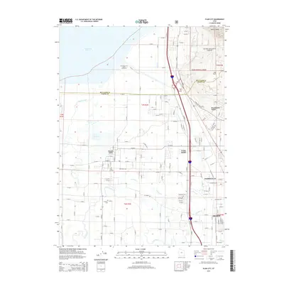
2014 Map of Plain City
USGS Topo · Published 2014About this map
Plain City and the neighboring settlements of Farr West and Harrisville occupy a landscape defined by the transition from the high Wasatch Range to the wetlands bordering the Great Salt Lake. This 2014 edition shows a well-established grid of rural roads and irrigation channels that support the region's agricultural roots, even as residential growth expands near Ogden. Significant water features like the Weber River, Fourmile Cr, and the expansive Willard Bay Reservoir dominate the western half of the map. Genealogical interests are served by the inclusion of the Plain City Cem and the W Weber Cem, while the northern portion of the quadrangle highlights the recreational and natural areas of Cache National Forest and the Willard Bay South Marina Campground. The unique geothermic feature Utah Hot Springs sits at the base of the mountains, marking a historical point of interest along the modern highway corridors.
Find a feature on this map
138 named features on this map. Tap any name to fly to it.
Don’t see what you’re looking for? This feature index may not catch every label — zoom into the map to look around manually.
Map Details
Editions of this 2014 Plain City Map
This is the sole edition of this map. No revisions or reprints were ever made.
Other maps of this area

1954 · Whistler Canal
USGS Topo · 1:24,000

1954 · Ogden
USGS Topo · 1:250,000

1954 · Brigham City
USGS Topo · 1:250,000

1955 · Ogden
USGS Topo · 1:24,000

1955 · Plain City
USGS Topo · 1:24,000

1955 · Roy
USGS Topo · 1:24,000

1955 · Mantua
USGS Topo · 1:24,000

1955 · Plain City SW
USGS Topo · 1:24,000

1955 · Willard
USGS Topo · 1:24,000

1955 · North Ogden
USGS Topo · 1:24,000