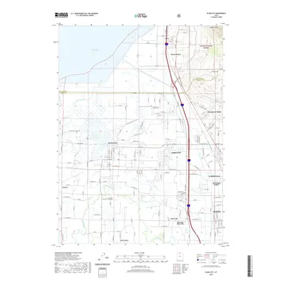
2020 Map of Plain City
USGS Topo · Published 2020About this map
The Weber River winds through this agricultural and residential corridor, anchoring a network of irrigation and drainage that includes Fourmile Cr, Mill Cr, and First Salt Cr. This landscape reflects the intersection of traditional farming communities and modern residential growth, with the western edge defined by the expanses of the Willard Bay Reservoir. The Little Mountain Rail Trail follows a former transportation corridor through Plain City, providing a physical link to the area's transit history. To the east, the terrain rises sharply into the Wasatch Range, where the Cache National Forest begins. Local genealogists will find the Plain City Cem and West Weber-Taylor Cem well-situated within their respective communities, marking the long-established presence of settlements like Slaterville and Warren north of Ogden.
Find a feature on this map
81 named features on this map. Tap any name to fly to it.
Don’t see what you’re looking for? This feature index may not catch every label — zoom into the map to look around manually.
Map Details
Editions of this 2020 Plain City Map
This is the sole edition of this map. No revisions or reprints were ever made.
Other maps of this area

1954 · Whistler Canal
USGS Topo · 1:24,000

1954 · Ogden
USGS Topo · 1:250,000

1954 · Brigham City
USGS Topo · 1:250,000

1955 · Ogden
USGS Topo · 1:24,000

1955 · Plain City
USGS Topo · 1:24,000

1955 · Roy
USGS Topo · 1:24,000

1955 · Mantua
USGS Topo · 1:24,000

1955 · Plain City SW
USGS Topo · 1:24,000

1955 · Willard
USGS Topo · 1:24,000

1955 · North Ogden
USGS Topo · 1:24,000