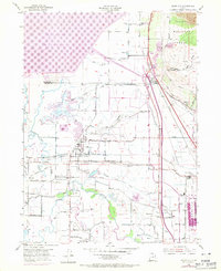
1969 Map of Plain City
USGS Topo · Published 1971About this map
Utah Hot Springs and the surrounding wetlands of Mud Flat anchor the northern reaches of this map, illustrating the specialized landscape of the eastern shore of the Great Salt Lake. The 1969 photorevisions reveal the expansion of the Willard Reservoir and the industrial footprint of the Salt Evaporator, signaling the mid-century intensification of water management and mineral extraction in Weber County. The irrigation network is particularly dense here, with the West Canal, Warren Canal, and Willard Canal cutting across the terrain to support the agricultural settlements of Plain City and Slaterville.
Find a feature on this map
73 named features on this map. Tap any name to fly to it.
Don’t see what you’re looking for? This feature index may not catch every label — zoom into the map to look around manually.
Map Details
Editions of this 1969 Plain City Map
This is the sole edition of this map. No revisions or reprints were ever made.
Other maps of this area

1954 · Whistler Canal
USGS Topo · 1:24,000

1954 · Ogden
USGS Topo · 1:250,000

1954 · Brigham City
USGS Topo · 1:250,000

1955 · Ogden
USGS Topo · 1:24,000

1955 · Plain City
USGS Topo · 1:24,000

1955 · Roy
USGS Topo · 1:24,000

1955 · Mantua
USGS Topo · 1:24,000

1955 · Plain City SW
USGS Topo · 1:24,000

1955 · Willard
USGS Topo · 1:24,000

1955 · North Ogden
USGS Topo · 1:24,000