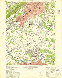
1947 Map of Plainfield
USGS Topo · Published 1947About this map
Camp Kilmer and the industrial corridors of central New Jersey dominate this post-war landscape, showing the dense intersection of rail and road networks in the late 1940s. The urban centers of Plainfield and New Brunswick are connected by a web of significant transportation lines, including the Central Railroad of New Jersey and the Lehigh Valley Railroad. While much of the area shows emerging suburban development, older settlements like Pumptown and New Durham remain distinct landmarks.
Find a feature on this map
64 named features on this map. Tap any name to fly to it.
Don’t see what you’re looking for? This feature index may not catch every label — zoom into the map to look around manually.
Map Details
Editions of this 1947 Plainfield Map
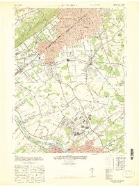
2 editions found
Other maps of this area

1888 · Plainfield
USGS Topo · 1:62,500

1888 · New Brunswick
USGS Topo · 1:62,500

1888 · Princeton
USGS Topo · 1:62,500

1891 · Somerville
USGS Topo · 1:62,500

1893 · New Brunswick
USGS Topo · 1:62,500

1893 · Plainfield
USGS Topo · 1:62,500

1893 · Somerville
USGS Topo · 1:62,500

1894 · Princeton
USGS Topo · 1:62,500

1898 · Plainfield
USGS Topo · 1:62,500

1898 · Somerville
USGS Topo · 1:62,500