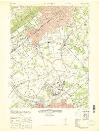
1947 Map of Plainfield
USGS Topo · Published 1947About this map
Camp Kilmer and the Raritan Arsenal dominate the southern landscape in this 1947 post-war view, marking a significant military presence in the corridor between Plainfield and New Brunswick. The map captures a moment of intense industrial and transit connectivity, with the Central Railroad of New Jersey, Lehigh Valley Railroad, and Reading Railroad crisscrossing the region. These rail lines served the dense residential blocks of North Plainfield and Dunellen, as well as emerging aviation hubs like Hadley Airport.
Find a feature on this map
73 named features on this map. Tap any name to fly to it.
Don’t see what you’re looking for? This feature index may not catch every label — zoom into the map to look around manually.
Map Details
Editions of this 1947 Plainfield Map
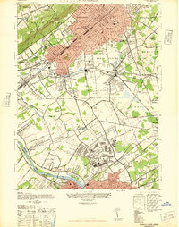
2 editions found
Other maps of this area

1888 · Plainfield
USGS Topo · 1:62,500

1888 · New Brunswick
USGS Topo · 1:62,500

1888 · Princeton
USGS Topo · 1:62,500

1891 · Somerville
USGS Topo · 1:62,500

1893 · New Brunswick
USGS Topo · 1:62,500

1893 · Plainfield
USGS Topo · 1:62,500

1893 · Somerville
USGS Topo · 1:62,500

1894 · Princeton
USGS Topo · 1:62,500

1898 · Plainfield
USGS Topo · 1:62,500

1898 · Somerville
USGS Topo · 1:62,500