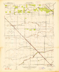
1947 Map of Plainsburg
USGS Topo · Published 1947About this map
Plainsburg and Le Grand anchor this agricultural landscape in the San Joaquin Valley just after World War II, where the network of sloughs and ditches reveals a complex system of water management. The terrain is defined by the Chowchilla River and its overflow channels, including North Slough and Ash Slough, which weave through a grid of section lines dotted with dozens of windmills. Transportation is dominated by the heavy rail presence of the Southern Pacific and the Atchison Topeka and Santa Fe Road, which facilitated the movement of goods from local sidings and settlements like Athlone and Minturn.
Find a feature on this map
26 named features on this map. Tap any name to fly to it.
Don’t see what you’re looking for? This feature index may not catch every label — zoom into the map to look around manually.
Map Details
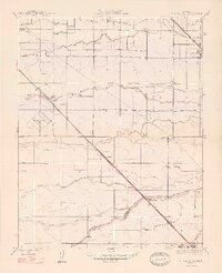
Editions of this 1947 Plainsburg Map
2 editions found
Other maps of this area

1914 · Merced
USGS Topo · 1:31,680

1915 · Owens Creek
USGS Topo · 1:31,680

1916 · Berenda
USGS Topo · 1:31,680

1917 · Merced
USGS Topo · 1:31,680

1918 · Bliss Ranch
USGS Topo · 1:31,680

1918 · Owens Creek
USGS Topo · 1:31,680

1918 · Lingard
USGS Topo · 1:31,680

1918 · Chowchilla
USGS Topo · 1:31,680

1918 · Berenda
USGS Topo · 1:31,680

1918 · Planada
USGS Topo · 1:31,680