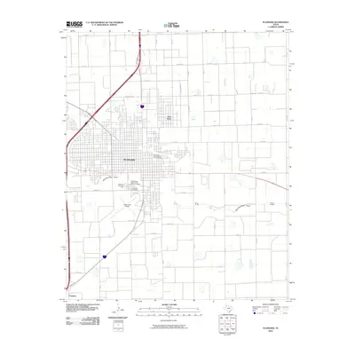
2010 Map of Plainview
USGS Topo · Published 2010About this map
Plainview serves as the central hub of this High Plains landscape, where the concentrated grid of the Plainview Commercial Historic District anchors the surrounding agricultural and suburban expansion. The era's transportation network is defined by a dense lattice of farm-to-market roads and county routes, including FM 400 and FM 3183, which connect the main city to outlying areas like Seth Ward and the small settlement of Furguson to the southwest.
Find a feature on this map
46 named features on this map. Tap any name to fly to it.
Don’t see what you’re looking for? This feature index may not catch every label — zoom into the map to look around manually.
Map Details
Editions of this 2010 Plainview Map
This is the sole edition of this map. No revisions or reprints were ever made.
Other maps of this area

1954 · Plainview
USGS Topo · 1:250,000

1958 · Plainview
USGS Topo · 1:250,000

1965 · Kress West
USGS Topo · 1:24,000

1965 · Wasson
USGS Topo · 1:24,000

1965 · Plainview
USGS Topo · 1:24,000

1968 · Happy Union
USGS Topo · 1:24,000

1968 · Plainview SE
USGS Topo · 1:24,000
1968 · Hale Center
USGS Topo · 1:24,000

1968 · Aiken
USGS Topo · 1:24,000

1969 · Kress East
USGS Topo · 1:24,000