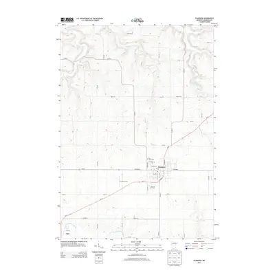
2013 Map of Plainview
USGS Topo · Published 2013About this map
The agricultural hub of Plainview anchors this survey of southeastern Minnesota, situated on a high plateau between the branching drainages of the North Fork Whitewater River and West Indian Creek. The town's grid is clearly defined by local thoroughfares like W Broadway and N Wabasha, surrounding local institutions such as the Po and the Greenwood Cem. To the west, the smaller settlement of Elgin sits near the river's edge, while Holzer Farms and Christison Airport mark the rural expanses in between.
Find a feature on this map
52 named features on this map. Tap any name to fly to it.
Don’t see what you’re looking for? This feature index may not catch every label — zoom into the map to look around manually.
Map Details
Editions of this 2013 Plainview Map
This is the sole edition of this map. No revisions or reprints were ever made.
Other maps of this area

1932 · Wabasha
USGS Topo · 1:62,500

1934 · Plainview
USGS Topo · 1:62,500

1935 · Rochester
USGS Topo · 1:48,000

1938 · Plainview
USGS Topo · 1:62,500

1939 · Rochester
USGS Topo · 1:62,500

1951 · Wabasha
USGS Topo · 1:62,500

1951 · Lake City
USGS Topo · 1:62,500

1953 · Saint Paul
USGS Topo · 1:250,000

1959 · Saint Paul
USGS Topo · 1:250,000
1972 · Plainview
USGS Topo · 1:24,000