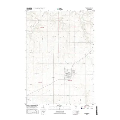
2016 Map of Plainview
USGS Topo · Published 2016About this map
Plainview serves as the primary hub of this southeastern Minnesota landscape, where the grid of city streets including W Broadway and 1st Ave NW meets the surrounding agricultural expanse. The town is flanked by historic burial grounds such as Saint Joachim Cem and Greenwood Cem, which provide important touchpoints for local genealogical research. To the southwest, the smaller settlement of Elgin sits near the map's edge, connected to the regional network by Co Rd 25.
Find a feature on this map
44 named features on this map. Tap any name to fly to it.
Don’t see what you’re looking for? This feature index may not catch every label — zoom into the map to look around manually.
Map Details
Editions of this 2016 Plainview Map
This is the sole edition of this map. No revisions or reprints were ever made.
Other maps of this area

1932 · Wabasha
USGS Topo · 1:62,500

1934 · Plainview
USGS Topo · 1:62,500

1935 · Rochester
USGS Topo · 1:48,000

1938 · Plainview
USGS Topo · 1:62,500

1939 · Rochester
USGS Topo · 1:62,500

1951 · Wabasha
USGS Topo · 1:62,500

1951 · Lake City
USGS Topo · 1:62,500

1953 · Saint Paul
USGS Topo · 1:250,000

1959 · Saint Paul
USGS Topo · 1:250,000
1972 · Plainview
USGS Topo · 1:24,000