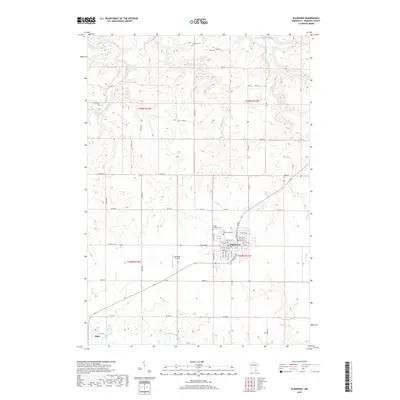
2019 Map of Plainview
USGS Topo · Published 2019About this map
Plainview serves as the primary municipal center in this section of Wabasha County, situated within a landscape defined by the drainage basins of several prominent local waterways. The town's grid is clearly delineated, featuring schools and residential blocks that transition into the surrounding agricultural lands. To the west, the smaller settlement of Elgin sits near the banks of the N Fork Whitewater River, which meanders through the southern portion of the quadrangle. The topography is notably marked by the erosion patterns of Middle Cr, Long Cr, and W Indian Cr, creating a series of ridges and valleys that dictate the local road network. Local history and genealogy interests are anchored by several established burial grounds, including Saint Joachim Cem, Greenwood Cem, and Oakwood Cem, while the Christison Airport provides a modern transportation link for the rural community.
Find a feature on this map
39 named features on this map. Tap any name to fly to it.
Don’t see what you’re looking for? This feature index may not catch every label — zoom into the map to look around manually.
Map Details
Editions of this 2019 Plainview Map
This is the sole edition of this map. No revisions or reprints were ever made.
Other maps of this area

1932 · Wabasha
USGS Topo · 1:62,500

1934 · Plainview
USGS Topo · 1:62,500

1935 · Rochester
USGS Topo · 1:48,000

1938 · Plainview
USGS Topo · 1:62,500

1939 · Rochester
USGS Topo · 1:62,500

1951 · Wabasha
USGS Topo · 1:62,500

1951 · Lake City
USGS Topo · 1:62,500

1953 · Saint Paul
USGS Topo · 1:250,000

1959 · Saint Paul
USGS Topo · 1:250,000
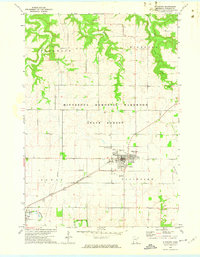
1972 · Plainview
USGS Topo · 1:24,000