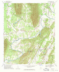
1968 Map of Plainville
USGS Topo · Published 1971About this map
The Oostanaula River carves a winding path through the valley between Horn Mountain and Turkey Mountain, anchoring a landscape of small agricultural settlements and wooded ridges. In this 1960s snapshot, the community of Plainville serves as a local hub along the Southern Railway, which parallels the river's eastern bank. The terrain transition is sharp, moving from the dense timber of the Chattahoochee National Forest to the open river bends like Horton Bend. Local life is marked by numerous country churches and cemeteries, such as New Hope Ch near Rosedale and Everett Springs Ch. Significant institutional presence is noted at the Georgia Cumberland Academy north of Reeves, while the map also tracks industrial activity through scattered Gravel Pits and the Shale Pits near Everett Springs.
Find a feature on this map
67 named features on this map. Tap any name to fly to it.
Don’t see what you’re looking for? This feature index may not catch every label — zoom into the map to look around manually.
Map Details
Editions of this 1968 Plainville Map
2 editions found
Other maps of this area

1886 · Dalton
USGS Topo · 1:125,000

1886 · Ringgold
USGS Topo · 1:125,000

1886 · Rome
USGS Topo · 1:125,000

1890 · Cartersville
USGS Topo · 1:125,000

1891 · Cartersville
USGS Topo · 1:125,000

1892 · Ringgold
USGS Topo · 1:125,000

1892 · Dalton
USGS Topo · 1:125,000

1896 · Cartersville
USGS Topo · 1:125,000

1897 · Dalton
USGS Topo · 1:125,000

1898 · Rome
USGS Topo · 1:125,000