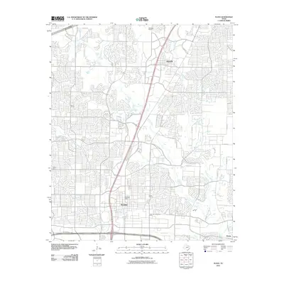
2010 Map of Plano
USGS Topo · Published 2010About this map
Plano and Allen appear here as rapidly maturing suburban centers at the start of the 21st century, defined by a dense network of residential streets and essential civic infrastructure. The landscape is oriented around the central corridor of K Ave and the expansive road system of the North Dallas suburbs, including Park Blvd and E Plano Pkwy. Despite the heavy development, the natural hydrology of Collin County remains a core feature, with Rowlett Creek and its tributaries like Pittman Creek, Spring Creek, and Beck Branch winding through the gridded neighborhoods. Genealogists and local historians can locate early burial sites such as Bethany Cemetery and Mutual Cemetery, which stand as landmarks of the area's pre-suburban era. Public facilities like the Downtown Plano Post Office and the Municipal Golf Course highlight the civic character of the city as it reached its modern proportions.
Find a feature on this map
52 named features on this map. Tap any name to fly to it.
Don’t see what you’re looking for? This feature index may not catch every label — zoom into the map to look around manually.
Map Details
Editions of this 2010 Plano Map
This is the sole edition of this map. No revisions or reprints were ever made.
Other maps of this area

1891 · Dallas
USGS Topo · 1:125,000

1893 · Dallas
USGS Topo · 1:125,000

1924 · Mc Kinney 4-d
USGS Topo · 1:48,000

1929 · Frisco
USGS Topo · 1:62,500

1929 · McKinney
USGS Topo · 1:62,500

1931 · Carrollton
USGS Topo · 1:62,500

1954 · Dallas
USGS Topo · 1:250,000

1954 · Sherman
USGS Topo · 1:250,000

1958 · Dallas
USGS Topo · 1:250,000

1958 · Sherman
USGS Topo · 1:250,000