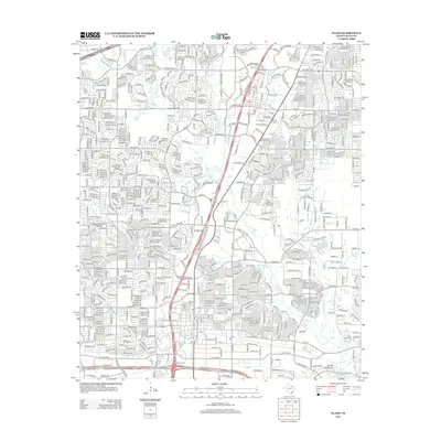
2013 Map of Plano
USGS Topo · Published 2013About this map
Plano's landscape in the early 21st century reveals a dense network of suburban development defined by its intricate drainage patterns. Watercourses like Rowlett Cr, Spring Cr, and Cottonwood Cr wind through the city's residential blocks, often serving as the boundaries for parks and open spaces. Older community landmarks remain visible amidst the modern grid, including Bethany Cem and Mutual Cem, providing critical points of reference for genealogists studying the area's local history. The road network is dominated by major thoroughfares such as President George Bush Tpke W and W Parker Rd, which facilitate the region's rapid growth. This survey captures the transition of formerly agricultural land into a complex urban environment, where smaller tributaries like Russell Cr and Beck Br still chart the original topography of Collin County.
Find a feature on this map
32 named features on this map. Tap any name to fly to it.
Don’t see what you’re looking for? This feature index may not catch every label — zoom into the map to look around manually.
Map Details
Editions of this 2013 Plano Map
This is the sole edition of this map. No revisions or reprints were ever made.
Other maps of this area

1891 · Dallas
USGS Topo · 1:125,000

1893 · Dallas
USGS Topo · 1:125,000

1924 · Mc Kinney 4-d
USGS Topo · 1:48,000

1929 · Frisco
USGS Topo · 1:62,500

1929 · McKinney
USGS Topo · 1:62,500

1931 · Carrollton
USGS Topo · 1:62,500

1954 · Dallas
USGS Topo · 1:250,000

1954 · Sherman
USGS Topo · 1:250,000

1958 · Dallas
USGS Topo · 1:250,000

1958 · Sherman
USGS Topo · 1:250,000