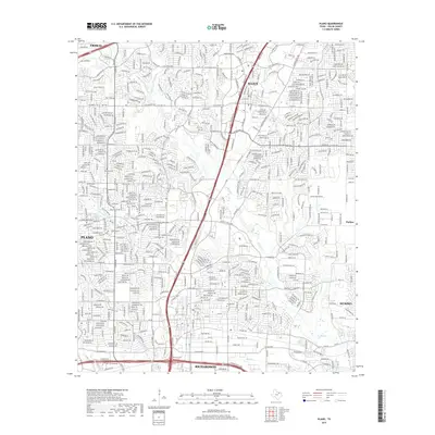
2019 Map of Plano
USGS Topo · Published 2019About this map
Plano and its northern neighbors, Allen and Frisco, appear in a state of dense residential growth and suburban expansion at the close of the 2010s. The landscape is defined by an intricate network of local streets, master-planned developments, and major transit arteries like E George Bush Tpke and W Plano Pkwy. Despite this modern sprawl, the natural drainage patterns of the Blackland Prairie remain visible, with Rowlett Cr and its tributaries, including Bowman Br and Cottonwood Cr, carving greenbelts through the residential blocks. Remnants of the area's earlier rural history are preserved at Bethany Cem and Mutual Cem, which stand as quiet landmarks amidst the surrounding neighborhood density that now connects Plano to Murphy and Richardson.
Find a feature on this map
36 named features on this map. Tap any name to fly to it.
Don’t see what you’re looking for? This feature index may not catch every label — zoom into the map to look around manually.
Map Details
Editions of this 2019 Plano Map
This is the sole edition of this map. No revisions or reprints were ever made.
Other maps of this area

1891 · Dallas
USGS Topo · 1:125,000

1893 · Dallas
USGS Topo · 1:125,000

1924 · Mc Kinney 4-d
USGS Topo · 1:48,000

1929 · Frisco
USGS Topo · 1:62,500

1929 · McKinney
USGS Topo · 1:62,500

1931 · Carrollton
USGS Topo · 1:62,500

1954 · Dallas
USGS Topo · 1:250,000

1954 · Sherman
USGS Topo · 1:250,000

1958 · Dallas
USGS Topo · 1:250,000

1958 · Sherman
USGS Topo · 1:250,000