2022 Map of Plano
USGS Topo · Published 2022About this map
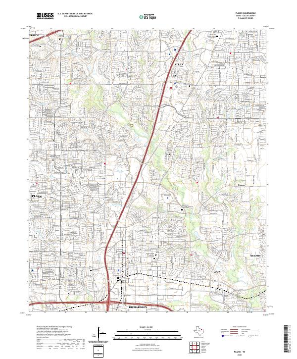
Plano and its neighboring communities of Allen, Frisco, and Richardson are depicted at a point of dense suburban development along the Central Expy corridor. The landscape is defined by the branching tributaries of Rowlett Creek, including Bowman Br, Beck Br, and Brown Br, which wind through established residential neighborhoods. A notable concentration of modern memorial sites is evident, with several columbariums integrated into local parish grounds like the Messiah Lutheran Church Columbarium.
Find a feature on this map
37 named features on this map. Tap any name to fly to it.
Don’t see what you’re looking for? This feature index may not catch every label — zoom into the map to look around manually.
Map Details
Editions of this 2022 Plano Map
This is the sole edition of this map. No revisions or reprints were ever made.