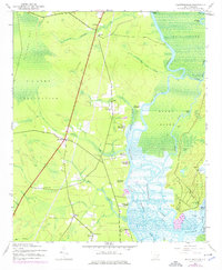
1943 Map of Plantersville
USGS Topo · Published 1976About this map
Historic rice culture and riverfront settlement define this landscape along the Pee Dee River and Waccamaw River in the early 1940s. The map illustrates a dense concentration of riverine estates including Bates Hill Plantation, Holly Grove Plantation, and Chicora Wood Plantation, documenting the land divisions of Georgetown County before late-century modernization. The sprawling wetlands of Bull Island and Sandy Island are carved by intricate waterways like Bull Creek and the Thoroughfare, showing a region where water remained the primary corridor for commerce and transport. Inland, the influence of the U S Army Reservation borders the expansive Carvers Bay, while small community centers such as Plantersville and Belin serve the rural population. Local life is further detailed through landmarks like Prince Frederick Ch and several rural schools, including the Sandy Island Sch and St Mark Sch.
Find a feature on this map
45 named features on this map. Tap any name to fly to it.
Don’t see what you’re looking for? This feature index may not catch every label — zoom into the map to look around manually.
Map Details
Editions of this 1943 Plantersville Map
3 editions found
Other maps of this area

1942 · Magnolia Beach
USGS Topo · 1:24,000

1942 · Waverly Mills
USGS Topo · 1:24,000

1943 · Yauhannah
USGS Topo · 1:24,000

1943 · Bucksville
USGS Topo · 1:24,000

1943 · Carvers Bay
USGS Topo · 1:24,000

1943 · Brookgreen
USGS Topo · 1:24,000

1943 · Plantersville
USGS Topo · 1:24,000

1943 · Georgetown North
USGS Topo · 1:24,000

1943 · Outland
USGS Topo · 1:24,000

1944 · Outland
USGS Topo · 1:31,680