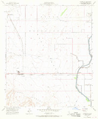
1957 Map of Plaster City
USGS Topo · Published 1968About this map
Plaster City serves as the industrial anchor for this corner of the Imperial Valley, defined by the large Gypsum Plant and its surrounding infrastructure. The landscape reveals a transition from the arid Yuha Desert to the engineered irrigation networks of the Westside. A network of water management features, including the Foxglove Canal and the Forget-Me-Not Canal, highlights the intensive effort to reclaim this desert terrain for agriculture. Transportation history is deeply layered here, featuring the Old Overland Stage Route alongside the San Diego and Arizona Eastern railroad. To the north, the Naval Reservation and a Parachute Testing Unit indicate the mid-century military presence in the region, while the Mining Railroad leading away from the gypsum works underscores the area's primary economic engine.
Find a feature on this map
28 named features on this map. Tap any name to fly to it.
Don’t see what you’re looking for? This feature index may not catch every label — zoom into the map to look around manually.
Map Details
Editions of this 1957 Plaster City Map
4 editions found
Other maps of this area

1915 · El Centro
USGS Topo · 1:125,000

1940 · Brawley
USGS Topo · 1:62,500

1940 · Heber
USGS Topo · 1:62,500

1940 · Plaster City
USGS Topo · 1:62,500

1940 · Coyote Wells
USGS Topo · 1:62,500

1942 · El Centro
USGS Topo · 1:250,000

1943 · Coyote Wells
USGS Topo · 1:62,500

1943 · Heber
USGS Topo · 1:62,500

1943 · Brawley
USGS Topo · 1:62,500

1944 · Plaster City
USGS Topo · 1:62,500