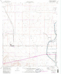
1957 Map of Plaster City
USGS Topo · Published 1979About this map
Plaster City serves as the industrial heart of this desert landscape, dominated by a large Gypsum Plant and its supporting infrastructure. The map illustrates a unique intersection of heavy industry, military operations, and historical transit corridors. To the north, the Naval Reservation Boundary encompasses the Recovery Parachute Test Range and a specialized Parachute Testing Unit, complete with an Observation Tower.
Find a feature on this map
28 named features on this map. Tap any name to fly to it.
Don’t see what you’re looking for? This feature index may not catch every label — zoom into the map to look around manually.
Map Details
Editions of this 1957 Plaster City Map
4 editions found
Other maps of this area

1915 · El Centro
USGS Topo · 1:125,000

1940 · Brawley
USGS Topo · 1:62,500

1940 · Heber
USGS Topo · 1:62,500

1940 · Plaster City
USGS Topo · 1:62,500

1940 · Coyote Wells
USGS Topo · 1:62,500

1942 · El Centro
USGS Topo · 1:250,000

1943 · Coyote Wells
USGS Topo · 1:62,500

1943 · Heber
USGS Topo · 1:62,500

1943 · Brawley
USGS Topo · 1:62,500

1944 · Plaster City
USGS Topo · 1:62,500