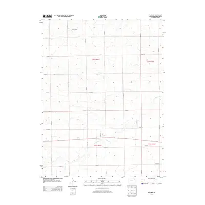
2013 Map of Platner
USGS Topo · Published 2013About this map
Platner serves as the central point of this High Plains landscape, situated along the primary east-west corridor of Us-34 E. The map reveals a highly structured agricultural grid, defined by a network of county roads such as CO Road JJ and CO Road LL that segment the Colorado prairie into precise sections. This geometric organization is occasionally interrupted by the wandering path of Surveyor Creek, which meanders through the southern half of the quadrangle. In the northwestern corner, Gebauer Airport provides a localized landmark for regional aviation. The map details a transition from the systematic road grid to the natural drainage patterns of the creek, illustrating how modern transportation and land management have adapted to the subtle relief of the Washington County terrain.
Find a feature on this map
26 named features on this map. Tap any name to fly to it.
Don’t see what you’re looking for? This feature index may not catch every label — zoom into the map to look around manually.
Map Details
Editions of this 2013 Platner Map
This is the sole edition of this map. No revisions or reprints were ever made.
Other maps of this area

1954 · Sterling
USGS Topo · 1:250,000

1958 · Sterling
USGS Topo · 1:250,000

1972 · Otis
USGS Topo · 1:24,000

1972 · Snyder Lake
USGS Topo · 1:24,000

1972 · Burdett
USGS Topo · 1:24,000

1973 · Akron
USGS Topo · 1:24,000

1973 · Platner
USGS Topo · 1:24,000

1973 · Buffalo Springs Ranch SE
USGS Topo · 1:24,000

1973 · Akron SE
USGS Topo · 1:24,000
1973 · Buffalo Springs Ranch
USGS Topo · 1:24,000