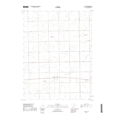
2019 Map of Platner
USGS Topo · Published 2019About this map
Platner sits along a primary east-west corridor in Washington County, defining the central landscape of this High Plains survey. The terrain is characterized by the meandering path of Surveyor Creek, which cuts through the southern half of the quadrangle, occasionally labeled as Surveyor Cr. The map reveals a highly structured agricultural grid, with a dense network of local roads such as Co RD 42 and Co RD HH that partition the land into regular sections. These roads, including Co Rd NN and Co RD LL, reflect the systematic settlement patterns common to eastern Colorado, where transportation follows the township and range boundaries of t3n r51w and t2n r50w. The convergence of these routes near the settlement of Platner underscores its role as a local focal point within the surrounding ranching and farming operations.
Find a feature on this map
25 named features on this map. Tap any name to fly to it.
Don’t see what you’re looking for? This feature index may not catch every label — zoom into the map to look around manually.
Map Details
Editions of this 2019 Platner Map
This is the sole edition of this map. No revisions or reprints were ever made.
Other maps of this area

1954 · Sterling
USGS Topo · 1:250,000

1958 · Sterling
USGS Topo · 1:250,000

1972 · Otis
USGS Topo · 1:24,000

1972 · Snyder Lake
USGS Topo · 1:24,000

1972 · Burdett
USGS Topo · 1:24,000

1973 · Akron
USGS Topo · 1:24,000

1973 · Platner
USGS Topo · 1:24,000

1973 · Buffalo Springs Ranch SE
USGS Topo · 1:24,000

1973 · Akron SE
USGS Topo · 1:24,000
1973 · Buffalo Springs Ranch
USGS Topo · 1:24,000