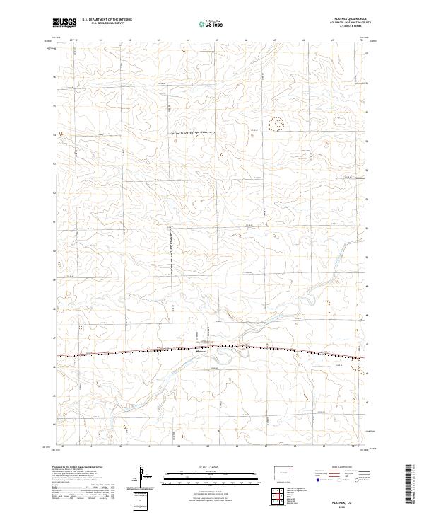
2022 Map of Platner
USGS Topo · Published 2022About this map
Platner serves as the central focal point for this section of Washington County, where the agricultural landscape is defined by a rigorous grid of section lines and county roads. The terrain is marked by the winding path of Surveyor Creek, which meanders across the township lines of t2n r51w and t3n r51w. This drainage system provides the primary relief in an otherwise rhythmic landscape of upland plains, where roads like Co RD KK and Co RD 44 delineate the boundaries of individual landholdings. The map documents the persistent settlement pattern of the High Plains, where the small community at Platner remains tied to the essential corridors of transport and water that have shaped the region since the earliest homesteading efforts.
Find a feature on this map
25 named features on this map. Tap any name to fly to it.
Don’t see what you’re looking for? This feature index may not catch every label — zoom into the map to look around manually.
Map Details
Editions of this 2022 Platner Map
This is the sole edition of this map. No revisions or reprints were ever made.
Other maps of this area

1954 · Sterling
USGS Topo · 1:250,000

1958 · Sterling
USGS Topo · 1:250,000

1972 · Otis
USGS Topo · 1:24,000

1972 · Snyder Lake
USGS Topo · 1:24,000

1972 · Burdett
USGS Topo · 1:24,000

1973 · Akron
USGS Topo · 1:24,000

1973 · Platner
USGS Topo · 1:24,000

1973 · Buffalo Springs Ranch SE
USGS Topo · 1:24,000

1973 · Akron SE
USGS Topo · 1:24,000
1973 · Buffalo Springs Ranch
USGS Topo · 1:24,000