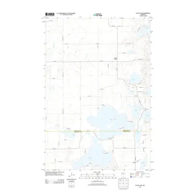
2013 Map of Platte Lake
USGS Topo · Published 2013About this map
Pine Center serves as the central settlement in this region of central Minnesota, positioned just north of the expansive Platte Lake. The landscape is defined by its dense concentration of water bodies and marshy lowlands, with the Platte River winding through the center of the sheet and connecting several large lakes. This 2013 survey illustrates a rural environment where development is largely clustered along the shorelines of Sullivan Lake, Platte Lake, and Peavy Lake. For genealogists and local historians, the map identifies specific community landmarks including Holy Family Cem near the eastern edge and Lakeview Cem further south. The extensive network of local roads such as Meadowview Rd and Cooley Dr shows the transition from agricultural tracts to lakeside residential plots that characterizes this portion of the Crow Wing and Morrison county line.
Find a feature on this map
57 named features on this map. Tap any name to fly to it.
Don’t see what you’re looking for? This feature index may not catch every label — zoom into the map to look around manually.
Map Details
Editions of this 2013 Platte Lake Map
This is the sole edition of this map. No revisions or reprints were ever made.
Other maps of this area

1912 · Deerwood
USGS Topo · 1:62,500

1914 · Deerwood
USGS Topo · 1:62,500

1915 · Brainerd
USGS Topo · 1:62,500

1918 · Brainerd
USGS Topo · 1:62,500

1948 · Lastrup
USGS Topo · 1:62,500

1950 · Lastrup
USGS Topo · 1:62,500

1953 · Duluth
USGS Topo · 1:250,000

1953 · Brainerd
USGS Topo · 1:250,000

1957 · Brainerd
USGS Topo · 1:250,000

1958 · Brainerd
USGS Topo · 1:250,000