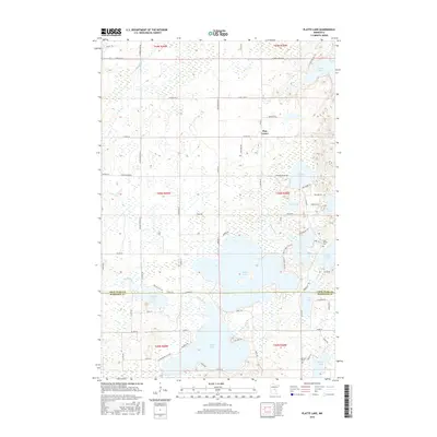
2016 Map of Platte Lake
USGS Topo · Published 2016About this map
Pine Center sits at the heart of this lake-strewn landscape where the borders of Crow Wing and Morrison counties meet. The map reveals a complex hydrologic network centered on the expansive Platte Lake, which is fed and drained by the Platte River. To the north, Dagger Brook meanders through extensive wetlands, connecting smaller basins like Camp Lake and Erskine Lake. This region is defined by its dense concentration of water bodies, including Sullivan Lake, Rock Lake, and Bulldog Lake, many of which are accessible by a network of local roads like N Platte Lake Rd and Pine Shores Dr. For those interested in local history and genealogy, the map identifies several significant landmarks, including the Holy Family Cem near the eastern shore of Bulldog Lake and the Lakeview Cem situated further south near Peavy Lake. The intricate shoreline of these lakes and the surrounding marshlands suggest a terrain shaped by glacial activity, where early settlement was closely tied to these natural water features.
Find a feature on this map
78 named features on this map. Tap any name to fly to it.
Don’t see what you’re looking for? This feature index may not catch every label — zoom into the map to look around manually.
Map Details
Editions of this 2016 Platte Lake Map
This is the sole edition of this map. No revisions or reprints were ever made.
Other maps of this area

1912 · Deerwood
USGS Topo · 1:62,500

1914 · Deerwood
USGS Topo · 1:62,500

1915 · Brainerd
USGS Topo · 1:62,500

1918 · Brainerd
USGS Topo · 1:62,500

1948 · Lastrup
USGS Topo · 1:62,500

1950 · Lastrup
USGS Topo · 1:62,500

1953 · Duluth
USGS Topo · 1:250,000

1953 · Brainerd
USGS Topo · 1:250,000

1957 · Brainerd
USGS Topo · 1:250,000

1958 · Brainerd
USGS Topo · 1:250,000