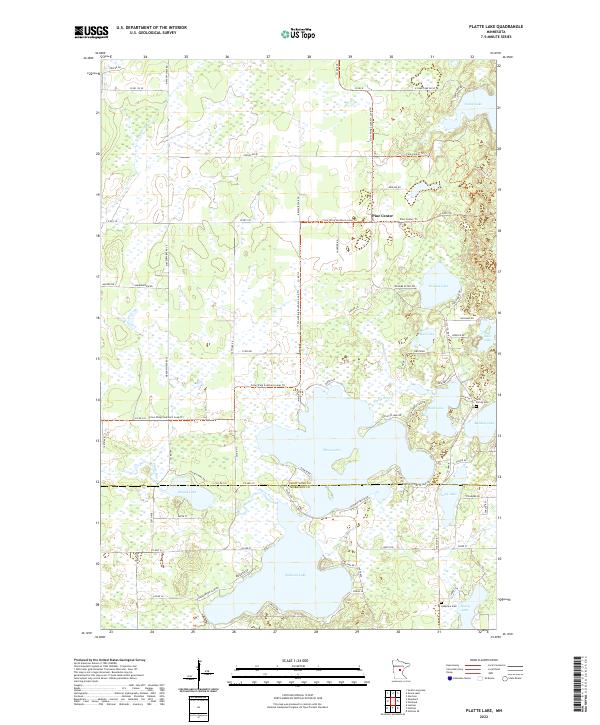
2022 Map of Platte Lake
USGS Topo · Published 2022About this map
Pine Center serves as the primary settlement hub in this region of central Minnesota, where the landscape is defined by an intricate network of glacial lakes and wetlands. The geography is dominated by large water bodies such as Platte Lake and Sullivan Lake, connected by the winding course of the Platte River. This area, straddling the border between Crow Wing and Morrison counties, shows a shift from organized township grids to the organic shoreline developments found near Rock Lake and Bulldog Lake. Local history and genealogy are anchored by sites such as Holy Family Cem near the eastern margin and Lakeview Cem further south. The map documents the modern footprint of the Crow Wing Southern Loop Trl, illustrating how recreational trails have integrated with older rural thoroughfares like Co Rd 2 SE and Pine Center Trl.
Find a feature on this map
81 named features on this map. Tap any name to fly to it.
Don’t see what you’re looking for? This feature index may not catch every label — zoom into the map to look around manually.
Map Details
Editions of this 2022 Platte Lake Map
This is the sole edition of this map. No revisions or reprints were ever made.
Other maps of this area

1912 · Deerwood
USGS Topo · 1:62,500

1914 · Deerwood
USGS Topo · 1:62,500

1915 · Brainerd
USGS Topo · 1:62,500

1918 · Brainerd
USGS Topo · 1:62,500

1948 · Lastrup
USGS Topo · 1:62,500

1950 · Lastrup
USGS Topo · 1:62,500

1953 · Duluth
USGS Topo · 1:250,000

1953 · Brainerd
USGS Topo · 1:250,000

1957 · Brainerd
USGS Topo · 1:250,000

1958 · Brainerd
USGS Topo · 1:250,000