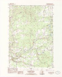
1983 Map of Platte River
USGS Topo · Published 1984About this map
The Pere Marquette State Forest dominates this section of Benzie County, where glacial geology left behind a dense network of kettle lakes and meandering tributaries. The Platte River winds westward through the center of the survey, flanked by numerous smaller water bodies like Pigeon Lake, Upper Woodcock Lake, and Eliza Lake. This landscape supported a mix of early industry and conservation, evidenced by the presence of Clarks Mill and the State Fish Hatchery. Small settlements and points of community interest, such as Almira and Allyn, are connected by a grid of named rural corridors like Fowler Road and Valley Road. Local genealogists will find value in the precise locations of the Almira Cem and Brundage Cem, while the Almira Ch and Lake Ann Camp mark the social centers of this wooded Michigan interior during the early 1980s.
Find a feature on this map
55 named features on this map. Tap any name to fly to it.
Don’t see what you’re looking for? This feature index may not catch every label — zoom into the map to look around manually.
Map Details
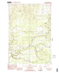
Editions of this 1983 Platte River Map
2 editions found
Other maps of this area

1954 · Traverse City
USGS Topo · 1:250,000

1954 · Manitowoc
USGS Topo · 1:250,000

1956 · Thompsonville
USGS Topo · 1:62,500

1956 · Frankfort
USGS Topo · 1:62,500

1957 · Empire
USGS Topo · 1:62,500

1957 · Maple City
USGS Topo · 1:62,500

1958 · Traverse City
USGS Topo · 1:250,000

1958 · Manitowoc
USGS Topo · 1:250,000

1976 · Thompsonville NE
USGS Topo · 1:24,000

1976 · Frankfort SE
USGS Topo · 1:24,000