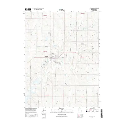
2015 Map of Plattsburg
USGS Topo · Published 2015About this map
Plattsburg serves as the focal point of this Clinton County landscape, where a dense network of local streets like W Broadway St and Railroad St reflect the community's established layout. The town is surrounded by several small burying grounds, including Greenlawn Cemetery and Calvary Cemetery, which offer valuable points of reference for those tracing family history in the region. The terrain is defined by the winding course of the Little Platte River and its various tributaries, such as Horse Fork and Grindstone Cr. To the south, the waters of Smithville Lake begin to emerge, while smaller bodies of water like Six Mile Lane Lake and the Plattsburg Old Reservoir are scattered throughout the agricultural uplands. Outlying settlements such as Wexford and Westbridge appear as small clusters within this rural Missouri landscape, connected by a web of county roads and named paths including NW Reservoir Rd and NW Norton Rd.
Find a feature on this map
83 named features on this map. Tap any name to fly to it.
Don’t see what you’re looking for? This feature index may not catch every label — zoom into the map to look around manually.
Map Details
Editions of this 2015 Plattsburg Map
This is the sole edition of this map. No revisions or reprints were ever made.
Other maps of this area

1890 · Kansas City
USGS Topo · 1:125,000

1894 · Kansas City
USGS Topo · 1:125,000

1894 · Independence
USGS Topo · 1:125,000

1914 · Smithville
USGS Topo · 1:62,500

1925 · Gower
USGS Topo · 1:62,500

1925 · Plattsburg
USGS Topo · 1:62,500

1936 · Kearney
USGS Topo · 1:48,000

1942 · Kearney
USGS Topo · 1:62,500

1945 · Kearney
USGS Topo · 1:62,500

1950 · Kansas City
USGS Topo · 1:250,000