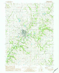
1984 Map of Plattsburg
USGS Topo · Published 1984About this map
Plattsburg serves as the central hub of this Missouri landscape, depicted just as the waters of Smithville Lake were being established to the southwest. The terrain is defined by the winding course of the Little Platte River and its many tributaries like Grindstone Creek and Horse Fork. A legacy of earlier transportation is visible in the Old Railroad Grade cutting across the countryside, while the local aviation community is marked by the Plattsburg Airpark and private strips like the Klmrey Landing Strip. Genealogists will find a dense concentration of burial sites, including the Log Ch Cem, Transue Cem, and Mt Washington Cem. The map also captures the Smithville Lake State Wildlife Area during its formative years, illustrating the conservation and infrastructure changes occurring near the border of Concord and Hardin townships in the early 1980s.
Find a feature on this map
34 named features on this map. Tap any name to fly to it.
Don’t see what you’re looking for? This feature index may not catch every label — zoom into the map to look around manually.
Map Details
Editions of this 1984 Plattsburg Map
This is the sole edition of this map. No revisions or reprints were ever made.
Other maps of this area

1890 · Kansas City
USGS Topo · 1:125,000

1894 · Kansas City
USGS Topo · 1:125,000

1894 · Independence
USGS Topo · 1:125,000

1914 · Smithville
USGS Topo · 1:62,500

1925 · Gower
USGS Topo · 1:62,500

1925 · Plattsburg
USGS Topo · 1:62,500

1936 · Kearney
USGS Topo · 1:48,000

1942 · Kearney
USGS Topo · 1:62,500

1945 · Kearney
USGS Topo · 1:62,500

1950 · Kansas City
USGS Topo · 1:250,000