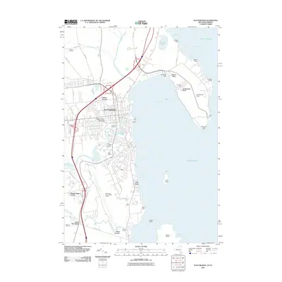
2012 Map of Plattsburgh
USGS Topo · Published 2012About this map
The city of Plattsburgh sits as a major hub on the western shore of Lake Champlain, defined by its historical university and modern transport infrastructure. The campus of the State University of New York at Plattsburgh is a central landmark, while to the south, the extensive Plattsburgh International Airport occupies a significant portion of the landscape. Coastal features include the prominent Cumberland Head peninsula, which reaches into the lake toward Crab Island and Valcour Island. Numerous burial grounds such as Riverside Cemetery, Mount Carmel Cemetery, and the Gilliland Cemetery provide valuable points of reference for local historians. The surrounding area is dotted with distinct neighborhoods and junctions like Halseys Corners, Cliff Haven, and South Junction, where the Saranac River and Salmon River empty into the bays of the lake.
Find a feature on this map
59 named features on this map. Tap any name to fly to it.
Don’t see what you’re looking for? This feature index may not catch every label — zoom into the map to look around manually.
Map Details
Editions of this 2012 Plattsburgh Map
This is the sole edition of this map. No revisions or reprints were ever made.
Other maps of this area

1894 · Plattsburg
USGS Topo · 1:62,500

1895 · Mooers
USGS Topo · 1:62,500

1895 · Rouse Point
USGS Topo · 1:62,500

1899 · Mooers
USGS Topo · 1:62,500

1906 · Plattsburg
USGS Topo · 1:62,500

1907 · Rouse Point
USGS Topo · 1:62,500

1913 · Dannemora
USGS Topo · 1:62,500

1939 · Rouses Point
USGS Topo · 1:62,500

1939 · Plattsburg
USGS Topo · 1:62,500

1941 · Plattsburg
USGS Topo · 1:62,500