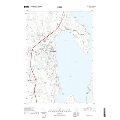
2019 Map of Plattsburgh
USGS Topo · Published 2019About this map
Plattsburgh sits at the confluence of the Saranac River and Lake Champlain, serving as a vital regional center near the New York and Vermont border. This modern landscape reveals the footprint of the former air base, now the Plattsburgh International Airport, which dominates the southern portion of the city. Education and governance define the urban core, anchored by the State University of New York at Plattsburgh and the Clinton County Government Center. The jagged shoreline of Cumberland Bay is marked by distinctive geological features like Cumberland Head and Rocky Point, while the interior is punctuated by historic burial grounds including Riverside Cem and Mount Carmel Cem. The map also traces the Salmon River as it approaches the lake, highlighting the transition from the dense street grids of Parc to the coastal enclave of Cliff Haven.
Find a feature on this map
143 named features on this map. Tap any name to fly to it.
Don’t see what you’re looking for? This feature index may not catch every label — zoom into the map to look around manually.
Map Details
Editions of this 2019 Plattsburgh Map
This is the sole edition of this map. No revisions or reprints were ever made.
Other maps of this area

1894 · Plattsburg
USGS Topo · 1:62,500

1895 · Mooers
USGS Topo · 1:62,500

1895 · Rouse Point
USGS Topo · 1:62,500

1899 · Mooers
USGS Topo · 1:62,500

1906 · Plattsburg
USGS Topo · 1:62,500

1907 · Rouse Point
USGS Topo · 1:62,500

1913 · Dannemora
USGS Topo · 1:62,500

1939 · Rouses Point
USGS Topo · 1:62,500

1939 · Plattsburg
USGS Topo · 1:62,500

1941 · Plattsburg
USGS Topo · 1:62,500