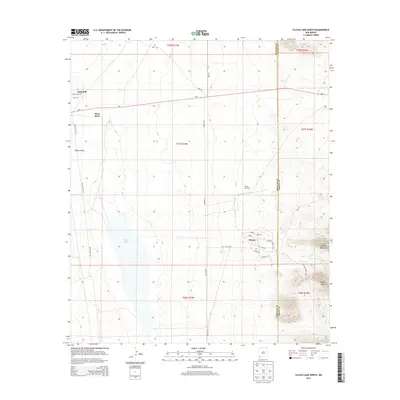
2013 Map of Playas Lake North
USGS Topo · Published 2013About this map
Playas serves as the primary hub in this arid landscape, situated at the eastern edge of the expansive Playas Valley. The settlement layout is remarkably structured, featuring residential streets like Sabana, Cholla, and Lomitas near the Playas Air Strip. This orderly grid contrasts sharply with the surrounding open terrain, which is dominated to the west by the ephemeral Playas Lake. To the east, the topography rises abruptly into the Little Hatchet Mountains, anchored by Playas Peak. The presence of small, remote points like White Place and Windmill along NM-9 reflects the sparse ranching and travel patterns typical of this corner of Hidalgo County. The road network, including Smelter Rd and Hurt Rd, suggests a landscape shaped by local industry and ranching access between the valley floor and the high peaks of the Hatchet range.
Find a feature on this map
32 named features on this map. Tap any name to fly to it.
Don’t see what you’re looking for? This feature index may not catch every label — zoom into the map to look around manually.
Map Details
Editions of this 2013 Playas Lake North Map
This is the sole edition of this map. No revisions or reprints were ever made.
Other maps of this area

1918 · Hachita
USGS Topo · 1:62,500

1918 · Playas
USGS Topo · 1:62,500

1919 · Playas
USGS Topo · 1:62,500

1954 · Silver City
USGS Topo · 1:250,000

1955 · Douglas
USGS Topo · 1:250,000

1958 · Silver City
USGS Topo · 1:250,000

1959 · Douglas
USGS Topo · 1:250,000

1961 · Douglas
USGS Topo · 1:250,000

1962 · Silver City
USGS Topo · 1:250,000

1964 · Douglas
USGS Topo · 1:250,000