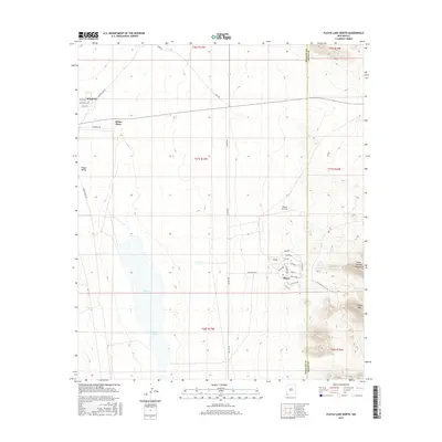
2017 Map of Playas Lake North
USGS Topo · Published 2017About this map
Playas and the surrounding Playas Valley define this arid landscape in southwestern New Mexico during the early twenty-first century. The town is organized around a distinctive grid of residential streets such as Palo Verde and Ocotillo Ave, situated adjacent to the Playas Air Strip. This settlement pattern, combined with the presence of Smelter Rd, reflects the area's industrial origins and its later transition into a specialized training facility. To the west, the expanse of Playas Lake occupies the valley floor, while the eastern edge of the map is dominated by the steep rises of the Little Hatchet Mountains and the prominent Playas Peak. Rural outposts like White Place and Windmill dot the northern reaches of the quadrangle, connected by ranch roads including Baker Ranch Rd and Hurt Rd, illustrating the sparse, functional layout of this remote desert basin.
Find a feature on this map
34 named features on this map. Tap any name to fly to it.
Don’t see what you’re looking for? This feature index may not catch every label — zoom into the map to look around manually.
Map Details
Editions of this 2017 Playas Lake North Map
This is the sole edition of this map. No revisions or reprints were ever made.
Other maps of this area

1918 · Hachita
USGS Topo · 1:62,500

1918 · Playas
USGS Topo · 1:62,500

1919 · Playas
USGS Topo · 1:62,500

1954 · Silver City
USGS Topo · 1:250,000

1955 · Douglas
USGS Topo · 1:250,000

1958 · Silver City
USGS Topo · 1:250,000

1959 · Douglas
USGS Topo · 1:250,000

1961 · Douglas
USGS Topo · 1:250,000

1962 · Silver City
USGS Topo · 1:250,000

1964 · Douglas
USGS Topo · 1:250,000