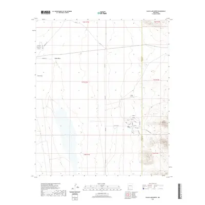
2020 Map of Playas Lake North
USGS Topo · Published 2020About this map
Playas is the primary settlement on this 2020 topographic map, situated along the eastern edge of the Playas Valley. The community layout features a distinct grid of streets with names such as Palo Verde, Mesilla, and Sabana. Immediately to the west, the ephemeral Playas Lake dominates the basin floor, while the rugged Little Hatchet Mountains and the prominent Playas Peak rise to the southeast.
Find a feature on this map
37 named features on this map. Tap any name to fly to it.
Don’t see what you’re looking for? This feature index may not catch every label — zoom into the map to look around manually.
Map Details
Editions of this 2020 Playas Lake North Map
This is the sole edition of this map. No revisions or reprints were ever made.
Other maps of this area

1918 · Hachita
USGS Topo · 1:62,500

1918 · Playas
USGS Topo · 1:62,500

1919 · Playas
USGS Topo · 1:62,500

1954 · Silver City
USGS Topo · 1:250,000

1955 · Douglas
USGS Topo · 1:250,000

1958 · Silver City
USGS Topo · 1:250,000

1959 · Douglas
USGS Topo · 1:250,000

1961 · Douglas
USGS Topo · 1:250,000

1962 · Silver City
USGS Topo · 1:250,000

1964 · Douglas
USGS Topo · 1:250,000