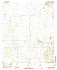
1982 Map of Playas Lake North
USGS Topo · Published 1982About this map
Industrial expansion in the New Mexico desert is evident in the planned settlement of Playas, a company town established to support regional mining interests. This 1982 provisional survey shows a highly structured community layout, complete with a Trailer Park, a dedicated Landing Strip, and even a Hellport. The proximity of the Phelps Dodge Industrial R.R. and an Old Railroad Grade underscores the area's importance to the mineral transport network of the late twentieth century.
Find a feature on this map
14 named features on this map. Tap any name to fly to it.
Don’t see what you’re looking for? This feature index may not catch every label — zoom into the map to look around manually.
Map Details
Editions of this 1982 Playas Lake North Map
This is the sole edition of this map. No revisions or reprints were ever made.
Other maps of this area

1918 · Hachita
USGS Topo · 1:62,500

1918 · Playas
USGS Topo · 1:62,500

1919 · Playas
USGS Topo · 1:62,500

1954 · Silver City
USGS Topo · 1:250,000

1955 · Douglas
USGS Topo · 1:250,000

1958 · Silver City
USGS Topo · 1:250,000

1959 · Douglas
USGS Topo · 1:250,000

1961 · Douglas
USGS Topo · 1:250,000

1962 · Silver City
USGS Topo · 1:250,000

1964 · Douglas
USGS Topo · 1:250,000