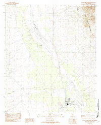
1982 Map of Playas Lake South
USGS Topo · Published 1982About this map
Playas Lake dominates this arid landscape at the beginning of the 1980s, revealing a dry lake bed managed by an extensive system of Levees. The southern end of the basin is marked by industrial activity centered around a massive Smelter, which includes specialized infrastructure like a Sewage Disposal Pond and nearby Levees to control local runoff. This industrial site sits at the interface of the flat basin floor and the rising slopes of the Little Hatchet Mountains to the east.
Find a feature on this map
11 named features on this map. Tap any name to fly to it.
Don’t see what you’re looking for? This feature index may not catch every label — zoom into the map to look around manually.
Map Details
Editions of this 1982 Playas Lake South Map
This is the sole edition of this map. No revisions or reprints were ever made.
Other maps of this area

1918 · Big Hatchet Peak
USGS Topo · 1:62,500

1918 · Hachita
USGS Topo · 1:62,500

1918 · Walnut Wells
USGS Topo · 1:62,500

1918 · Playas
USGS Topo · 1:62,500

1919 · Playas
USGS Topo · 1:62,500

1923 · Walnut Wells
USGS Topo · 1:62,500

1955 · Douglas
USGS Topo · 1:250,000

1959 · Douglas
USGS Topo · 1:250,000

1961 · Douglas
USGS Topo · 1:250,000

1964 · Douglas
USGS Topo · 1:250,000