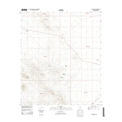
2013 Map of Playas Peak
USGS Topo · Published 2013About this map
Old Hachita sits at the eastern base of the Little Hatchet Mountains, serving as a focal point for this high-desert landscape in southwestern Grant County. The area is defined by a series of prominent peaks and ridges, including Turquoise Mtn, Beacon Hill, and Playas Peak, which oversee a network of canyons such as Water Canyon and Baylor Canyon. The settlement pattern follows the trajectory of NM-9, where small outposts like Pothook, Vista, and Minero are established along the desert floor.
Find a feature on this map
22 named features on this map. Tap any name to fly to it.
Don’t see what you’re looking for? This feature index may not catch every label — zoom into the map to look around manually.
Map Details
Editions of this 2013 Playas Peak Map
This is the sole edition of this map. No revisions or reprints were ever made.
Other maps of this area

1918 · Hachita
USGS Topo · 1:62,500

1918 · Playas
USGS Topo · 1:62,500

1919 · Playas
USGS Topo · 1:62,500

1954 · Silver City
USGS Topo · 1:250,000

1955 · Douglas
USGS Topo · 1:250,000

1958 · Silver City
USGS Topo · 1:250,000

1959 · Douglas
USGS Topo · 1:250,000

1961 · Douglas
USGS Topo · 1:250,000

1962 · Silver City
USGS Topo · 1:250,000

1964 · Douglas
USGS Topo · 1:250,000